We offer 1-3 meter, sub meter or sub foot accuracy. The utility can decide what level of accuracy they need.
Data can be delivered at the end of the project, week, day or every few minutes if the utility desires.
GIS- Working across different utility systems maps we see the good, the bad and the ugly in terms of GIS. We will be happy to discuss the pluses and minuses of each mapping software we encounter and give a non biased recommendation based on your specific needs.
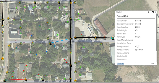
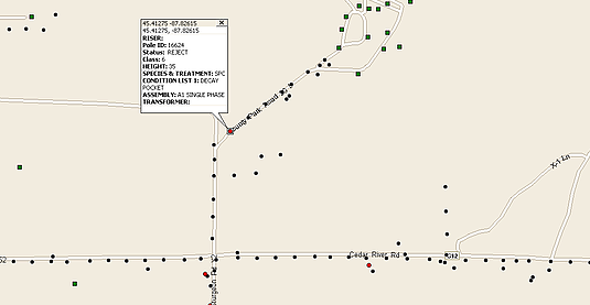
“A picture is worth a thousand words”…..now that’s a true statement when talking about a system map. We can and recommend to take a photo of each utility asset. The old way of just collecting the construction units of utility assets is not enough. A photo not only shows you the asset construction, it also shows you the style, setting, age and many times manufacturer of each asset. We can take photos from 4 different angles, or record a 360 degree video around each asset.